 Multi-Modal Transportation Planning Services
Our Approach
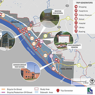
BPS develops context-sensitive, multi-modal transportation solutions for clients in urban, suburban, and rural areas at all levels, from states and regions to counties and municipalities. From Complete Streets polices to corridor plans, BPS offers a comprehensive set of services to meet our clients’ transportation needs. BPS is able to collect roadway and infrastructure data, perform traffic and user counts, identify travel generators and potential safety issues, and gather input from the jurisdiction and stakeholders in order to analyze the information and develop relevant, actionable, and customized recommendations to assist our clients in addressing their transportation-related needs and goals, whether it is in the form of a program, plan, policy, action strategy, code update, or a temporary demonstration project.
BPS approaches its transportation projects with the understanding that a jurisdiction’s transportation network should serve all of its users of all abilities so that they can safely, conveniently, and comfortably travel to their destinations using the mode that best serves them. In addition, transportation-land use connection should be recognized and transportation projects should be planned to be compatible with the surrounding land uses. This equitable and content-sensitive approach helps jurisdictions develop a more sustainable and resilient transportation network that serves people and freight both now and into the future as conditions may change.
Our Expertise
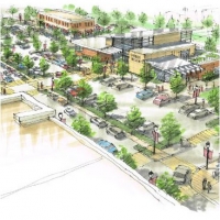
With our transportation planning expertise, we can focus on Equitable Access and Mobility Strategies for a specific mode of travel or a variety of modes, such as personal vehicles, pedestrians and bicyclists, transit, freight, and other forms of travel, such as micromobility and shared services. We can also develop projects in rural, suburban, and urban areas at varying scales, such as Complete Street Policies and Plans and Active Transportation Plans for states and regions to counties and communities; Long-Range Transportation Plans for regional planning organizations; Coordinated Transit-Human Services Plans and Thoroughfare Plans for rural areas and counties; Traffic Calming and Vision Zero Programs for communities; Safe Routes to Schools Programs and School Travel Plans for communities; Wayfinding for downtown areas; and Corridor, Safety, and Access Management Plans for specific roadway segments and intersections.
Other areas of expertise support development of these programs, plans, and policies, including performing Bike and Walk Audits; integrating different modes of travel, such as First-Mile/Last-Mile bicycle and pedestrian connections to support transit; performing Traffic Counts; and collecting Drone Aerial Imagery to help identify current issues and visualize potential solutions.
Our Services
SPECIALITIES
Complete Street Policies & Plans
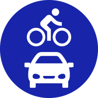
Bicycle & Pedestrian / Active Transportation Planning
Coordinated Transit-Human Services Plans
Transportation & NEPA
ADDITIONAL SERVICES
Equitable Access & Mobility Strategies
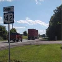
Rural Transportation Planning
Long Range Transportation Plans
Safe Routes to School Programs & School Travel Plans
Traffic Calming Programs & Studies
Transportation Corridor & Thoroughfare Planning
Access Management Plans
Transit Planning & First/Last-Mile Integration
Safety Studies, Crash Analyses & Vision Zero Initiatives
Micromobility Studies
Wayfinding
Bike & Walk Audits
Traffic Counts
Drone Aerial Imagery Collection
Integration of Services
Planning is an inherently integrative process, and our 3 service areas are often included in transportation projects.
Community Planning & Development
Environmental & Resiliency Planning
Education & Public Engagement